Saturday, January 29, 2022

A 'hidden' fort and spring, a mule park and a stud's grave

The "hidden" site of a Union Army on a hill in Franklin, Tenn.

Like this blog on Facebook | Follow me on Twitter 

A CIVIL WAR TRAVELOGUE: Saturday's excursion with history-minded pal Jack included visits to "hidden" Union Army sites and a little-known battlefield where a horse that sired more than 2,000 foals was buried. This type of information doesn't appear on all those other Civil War blogs. 😐

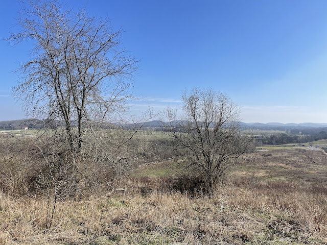
Let's start with a "hidden" site of a redan, a small, Union Army-built fort atop a hill along the Franklin Pike (State Route 31), about a mile north of the Franklin (Tenn.) square. Nathan Bedford Forrest, the notorious slave trader and cavalry genius, roamed this area, so the redan probably eased the minds of Union Army commanders. 

According to this map by a Civil War vet,
the Union Army parked mules on 
the west side of Franklin Pike.
(See more here.)
Two intriguing, old maps mark the location of the fort, which I visited for the first time earlier this week. One also shows where the U.S. Army parked its mules nearby, which I can't wait to tell Mrs. B, who surely will want to visit. The Union Army sure did a lot of mule parking, by the way.

No historical marker denotes the site of the fort, which must be rectified. According to a local historian, a house once stood at the crest of the hill and the many depressions in the ground below it may be the work of a farmer rather than Yankee soldiers.

Bundled to withstand the 25-degree temperature, Jack and I walked the ground and wondered what Civil War treasure might be unearthed beneath it. Spotted: One prancing deer, one pile of bricks and one child's outdoor playset that I don't think dated to 1864.

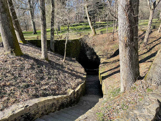
Tipped off by a knowledgeable source about a nearby "hidden" spring used by Union soldiers, we navigated through briars and who-knows-what else to find The Spot near the railroad track. (The line follows the same path as the wartime Nashville & Decatur Railroad.) Trees, fallen limbs, mud and a lack of courage prevented an up-close inspection. Does that make us "spring chickens"?
 
"Is that gurgling over there?" I said, pointing to the spring between the "V" in a fallen tree. "Maybe," said Jack, leery of getting closer. But I think he might have been humoring me. 

A "hidden" spring used by Union Army soldiers.
One of the war's largest cavalry battles was fought here on Dec. 17, 1864.

Next we headed across the pike to The Park at Harlindales Farm, roughly 200 acres of open space in exploding Franklin. The former breeding farm for Tennessee Walking Horses includes walking and hiking trails, a dog park and the Tractor Supply Co. Arena, where they hold polo matches and horse shows. 

Midnight Sun, superstar
On Dec. 17, 1864, in the aftermath of the Battle of Nashville, the rain-soaked and weary rearguard of John Bell Hood (aka "Old Woodenhead") clashed with Federal soldiers on this ground in one of the war's largest cavalry battles. Good luck finding the fine Civil War Trails marker that tells the story of a fight only nerds diehards seem to know anything about.

Steps from the CWT marker rest the earthly remains of walking horse superstar Midnight Sun, a black stallion said to be "as powerful as the sun and as black as midnight." Powerful with the ladies, too—this "sire of sires" may have fathered as many as 2,600 foals, which must be some sort of world record. Naturally, someone built a statue to Midnight Sun after his death in 1965.  

Whew! I'm exhausted. Until next time ... let's keep history alive. 👊

The grave of Midnight Sun, a black stallion that didn't have a lot of free time.

 — Have something to add (or correct) in this post? E-mail me here.

Friday, January 28, 2022

'Hidden' in plain sight: Fort location on Franklin (Tenn.) Pike

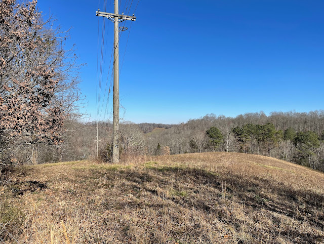
The view looking northwest of Franklin Pike (State Route 31) from the location
 of a wartime fort. (CLICK ON ALL IMAGES TO ENLARGE.)
A view from below the fort location.
Another view from below fort location. Could these be wartime trenches? Must investigate.

Like this blog on Facebook | Follow me on Twitter 

I recently explored the "hidden" location of a small Civil War fort along Franklin Pike (present-day State Route 31), a mile or so north of the square in Franklin, Tenn. The fort appears on two maps below—the first one is a cropped version of this map from the 9th Indiana Cavalry regimental history. The fort, designated by the "11," was unoccupied when the regiment fought north of Franklin on Dec. 17, 1864. On the second map, drawn by a Civil War veteran, the fort appears along the crease at the top middle. 

Thousands of U.S Army troops camped in the fields near this small fort during the war, as the second map below shows. It also shows the locations of headquarters, military and “contraband” camps and other nearby earthworks. Today those fields are occupied by houses, apartments, a park, retail, commercial … and a taco place Mrs. B is dying to visit. 

Fort Granger, a massive, earthen Union fort on the bluff above the Harpeth River, appears as that blob at the lower right of both maps. My Civil War pal Jack and I have explored the fort several times—I was even hypnotized there. It's worth your time to visit. If you really want to dig in, check out this doctoral dissertation,

Many “hidden” places like this small Franklin Pike fort remain throughout the Nashville area. So keep your eyes peeled. 😐

        GOOGLE STREET VIEW: Wartime fort location at left. Proceed south into Franklin.
Cropped enlargement of a map from 9th Indiana Cavalry regimental history shows outskirts
 of Franklin and death sites of three officers in the regiment in a battle on Dec. 17, 1864.
Map from parking lot historical marker at Fort Granger in Franklin, Tenn.
(Boyd Family Papers | Bancroft Library | University of California-Berkeley)

 — Have something to add (or correct) in this post? E-mail me here.

Sunday, January 23, 2022

Big Johnny's burgers, the KKK and a battle at Anthony's Hill

John Nelson stands near a wartime roadbed on core Anthony's Hill battlefield,
property his family has owned since 1869. (CLICK ON ALL IMAGES TO ENLARGE.)
Like this blog on Facebook | Follow me on Twitter 

A CIVIL WAR TRAVELOGUE: As I drive Mrs. B's SUV south on Columbia Pike in Franklin, co-pilot Jack—my hypnotist pal—raises a cup of joe as a salute to a "lost" wartime battlefield wall. Then, as we cruise through nearby Spring Hill, Jack wonders if the Hardee's hamburger joint was named for Confederate Lt. General William Hardee, something only Civil War nerds (or crazy people like us) do. 

Our destination: Pulaski, Tenn., about an hour's drive on State Route 31. 

We enjoyed a visit to Lynnville's Soda Pop Junction,
home of Big Johnny's burgers.
In Lynnville, torched by Yankees during the war, I order two massive Big Johnny's burgers at the oh-so-cool Soda Pop Junction and fried pies (apple and cherry) steps away at the Lynnville Fried Pie Factory. Evidently still hungry, Jack buys another treat, a "cupcake bomb" or something, which seems ominous. 

Then we're off to Richland Creek for a visit to the little-known battlefield where General John Bell Hood's Army of Tennessee fought in the aftermath of its catastrophic, mid-December 1864 defeat at Nashville. The gallant JBH—known by some misguided historians as "Old Woodenhead," which doesn't seem flattering at all—sure mastered retreatin' back in the day.

While cars whiz past us as we stand on a bridge over Richland Creek, Jack gets nervous but somehow finds the courage to read an account of the Christmas Eve 1864 cavalry battle—a fight that involved 6,000 Yankees, 3,000 Rebels and 20 cannon.  

No historical sign marks the Richland Creek battleground, and I'm almost positive the occupants of every vehicle that passes us wonder why two old dudes are outside in the cold—it's 27 degrees!—examining a book about Old Woodenhead's retreat. (Watch video.)

Richland Creek, where the armies fought on Christmas Eve 1864.
At Richland Creek, Union cavalry advanced on this ground toward the camera position.
At the Battle of Richland Creek, Confederate placed artillery somewhere in the left distance.

As we zoom to Pulaski, birthplace of the Klan, I consume the Big Johnny's burger, worrying if the delicious 1/3-pounder with tomato and the huge onion could cause my demiseand if it does, will Jack return the vehicle to Mrs. B? (Warning to Jack: If she finds a single, solitary gum wrapper left in the car, you will experience a wrath from hell.)

The tiny Sam Davis Memorial Museum.
Naturally, before we arrive in Pulaski, we pull off to the side of the busy road to read a weathered, state historical marker about some maneuverings by John Schofield—the U.S. Army general who flummoxed Hood at Spring Hill in November 1864. This shows we are:

A.) Nuts
B.) Devoid of common sense
C.) Must get out more
D.) All of the above

Few stop at this dangerous spot since the installation of the sign in, like, 1947. (For the historical record, Mrs. B votes for "B.")

On a ridge overlooking Pulaski, within site of the fabulous Giles County Courthouse in the square, we inspect the exterior of the Sam Davis Memorial Museum on the site where the U.S. Army hanged the 21-year-old Confederate spy in 1863. It may be the smallest musuem you'll ever see. 

Now I'm not naming names, but someone in our party—perhaps miffed the little place is closed on a Saturday—calls it a "munchkin museum," a description that I don't think appears in any Giles County visitors brochures. Meanwhile, I tap into my inner Mathew Brady for a photo of a large icicle hanging from the side of the architectural wonder.
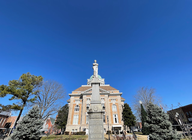
The Giles County Courthouse serves as backdrop for the Sam Davis monument in
the square in Pulaski, Tenn. (CLICK ON IMAGES TO ENLARGE.)
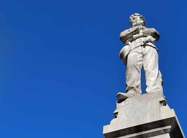
A statue of Sam Davis, the "Boy Hero of the Confederacy," in Pulaski's square.

A close-up of plaque on the Sam Davis monument.

The blank historical marker
on the building where
the KKK was founded
on Christmas Eve 1865.
After we park at the county courthouse, Jack marches off to check out some historical plaque, leaving me to wander about the square, where I examine the statue of spy Sam Davis—the "Boy Hero of the Confederacy.". 

Down the street, around the corner from a psychiatrist's office, stands the building where a small group of Confederate veterans founded the Klan on Christmas Eve 1865. In 1989, the bronze historical marker on its brick exterior was removed, flipped around with the words denoting its KKK association facing the building, and welded back into place. The owners of the building—an office for attorneys todaydidn't want it to become some weird place of worship for disgraceful Klan supporters.

With time to kill, we head on down the road to check out where Union scouts disguised as Confederates captured Davis while he dozed under a plum tree. You can't make this stuff up. Then we reverse course for the real reason I stole borrowed Mrs' B's vehicle. In journalism school at West Virginia University long ago, I learned this is called "burying the lede."
The view from where Forrest's artillery shelled the U.S. Army at the Battle of Anthony's Hill.
The bed of a wartime road on the Anthony's Hill battlefield.

On this deep-blue sky afternoon a few miles south of Pulaski, we meet John Nelson, the no-B.S. owner of a core section of the Anthony's Hill battlefield. After confirming our Civil War bonafides, the 83-year-old descendant of slaves shows us about his wooded, hilly property. Every time he walks the ground, owned by his family since 1869, Nelson thinks about the sacrifices his ancestors made to maintain it. Many of his kin rest in a cemetery across the road.

Using an Anthony's Hill map from Mud, Blood & Cold Steel
by Mark Zimmerman, Jack Richards and I explored 
the little-known battlefield near Pulaski, Tenn.
At Anthony's Hill on Christmas Day 1864, Nathan Bedford Forrestthe notorious slave trader and cavalry geniusambushed Union soldiers under Major General James Wilson. The weather was bleak, with rain mixed with snow, and freezing temperatures. 

Nearly continous fighting for more than a week had left both sides exhausted. Many of the Rebels went shoeless. Casualties numbered roughly 200 on both sides combined. A mortal wound took Christian Brenner, a private in the 5th Iowa Cavalry, from his wife Sarah Jane and their only child, 5-year-old Mary Charity. 

"So broken is the ground at this point, and so densely wooded, that there was no difficulty in effectually concealing troops," Confederate General Edward Wathall wrote of Anthony's Hill—one of the final fights for Hood's rearguard as his battered army lumbered toward Alabama.

Behind his house, near a coop of clucking chickens, Nelson points out ground where Forrest deployed artillery to shell the U.S. Army. To take in the magnificent view of the valley below, I crawl underneath barbed wire with the aid of another tramper. With a battlefield map in hand, Jack joins me.

Later, Nelson points out other landmarks—the wartime roadbed that slices through the heart of this hallowed ground, the site of the church used by Forrest as a hospital, the cemetery where Confederate dead from the battle rest. Instincts tell me there is a great story to tell about Nelson, Forrest and this long-forgotten battlefield.

Until then, we'll see you down the road. As always, let's keep history alive.👊👊 

Grave of a Confederate soldier who fell at Anthony's Hill.

 — Have something to add (or correct) in this post? E-mail me here.

SOURCE
  • Christian Brenner pension file, National Archives and Records Service, Washington D.C. via fold3.com (WC71703)
  • Zimmerman, Mark, Mud, Blood & Cold Steel: The Retreat from Nashville December 1864, Nashville: Zimco Publications LLC, 2020.

Saturday, January 22, 2022

A nerd's-eye view of obscure Richland Creek (Tenn.) battlefield


On Dec. 24, 1864 at Richland Creek, roughly eight miles north of Pulaski, Tenn., U.S. Army cavalry fought the rearguard of John Bell Hood's Army of Tennessee in the aftermath of the Battle of Nashville. Forces: 6,000 U.S. cavalry and 12 guns; 3,000 Confederate with eight guns. Visitors to battlefield besides my hypnotist pal Jack and I: 0. We were in good spirits because of stops earlier in the morning in nearby Lynnville at Soda Pop Junction for Big Johnny's burgers and then apple and cherry pies at the Lynnville Fried Pie Company. 😆

Saturday, January 15, 2022

A nerd's-eye view of obscure West Harpeth (Tenn.) battlefield

Historical sign at West Harpeth battlefield. (CLICK ON IMAGES TO ENLARGE.)

Like this blog on Facebook | Follow me on Twitter | Battle of the West Harpeth

You know you’re a Civil War nerd and perhaps in need of professional help when you ...


Defy death by walking across a bridge on super-busy State Route 31 (Columbia Pike) to stand at a creek where U.S. Army cavalry clashed with John Bell Hood’s rearguard in the obscure 
Battle of the West Harpeth on Dec. 17, 1864, in the aftermath of the Battle of Nashville. Curses to you, semi driver!

Get goosebumps when near the creek you pair a map with the site of the Rebels’ hollow square defense—a rarely used Civil War tactic.

Tennessee Virtual Archive

Pore over details of a post-war map of the battlefield made by Confederate veteran John Johnston, who served in Nathan Bedford Forrest's cavalry. The vet showed the scene of "our rally" near the creek and "my route" to the Gin House, which must have been interesting. 😛
.

Get giddy when you spot the possible trace of a wartime road and probable foundation of a wartime bridge across the creek—remains you had no idea existed.

Take this photo, looking north toward Franklin (roughly five miles distant), to show the advance of U.S Army cavalry (toward camera).

Stare at freshly turned earth at a construction site near the creek, hoping to spot a Minie ball or three. Then you tell a surveyor (breathlessly), “Hey, do you know a Civil War battle took place here?”

Drive through a neighborhood to get to the hill overlooking the obscure battlefield for just the right photo. Did the U.S. Army cavalry make it up here? What a view.

Let's keep history alive. 👊👊


 Have something to a add (or correct) in this post? E-mail me here.

Tuesday, January 11, 2022

In baby steps of Abraham Lincoln in Hodgenville, Kentucky

Fifty-six steps to the top -- one for every year of Lincoln's life.
I made it to the top, slightly winded.

Like this blog on Facebook | Follow me on Twitter

On Monday morning, I visited the birthplace of Abraham Lincoln at Sinking Spring Farm in Hodgenville, Ky. No, he didn’t live in this impressive structure. (Loved the lion door handle flourishes there, by the way. 😁) But inside there’s a replica of the one-room cabin he was born in on Feb. 12, 1809. Archaeologists found nothing at this site, a National Park Service employee told me. Lincoln mentioned living on a hill above a spring, so hence the memorial was built here. I checked out the spring, too. In 1811, the Lincolns moved to nearby Knob Creek Farm—much different topography there. Enjoyed walking in the baby steps of a great American on a frosty, deep-blue sky day.

The deep-blue sky made for an excellent backdrop.
The view from the Lincoln memorial.
A replica of the cabin on the site where Lincoln was born on Feb. 12, 1809.
Don't get handsy at the replica cabin.
Lion's door handles would be nice addition to Banks Manor.
A historical marker explains Sinking Spring.
Another view of the spring.
The spring (right) is below the memorial.

 Have something to add (or correct) in this post? E-mail me here.