Showing posts with label Franklin Pike. Show all posts

Saturday, January 29, 2022

A 'hidden' fort and spring, a mule park and a stud's grave

The "hidden" site of a Union Army on a hill in Franklin, Tenn.

Like this blog on Facebook | Follow me on Twitter 

A CIVIL WAR TRAVELOGUE: Saturday's excursion with history-minded pal Jack included visits to "hidden" Union Army sites and a little-known battlefield where a horse that sired more than 2,000 foals was buried. This type of information doesn't appear on all those other Civil War blogs. 😐

Let's start with a "hidden" site of a redan, a small, Union Army-built fort atop a hill along the Franklin Pike (State Route 31), about a mile north of the Franklin (Tenn.) square. Nathan Bedford Forrest, the notorious slave trader and cavalry genius, roamed this area, so the redan probably eased the minds of Union Army commanders. 

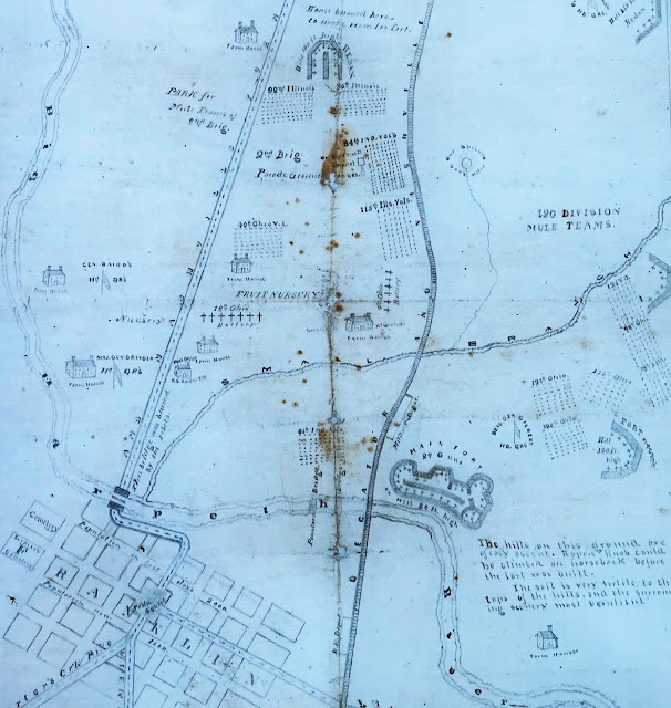
According to this map by a Civil War vet,
the Union Army parked mules on 
the west side of Franklin Pike.
(See more here.)
Two intriguing, old maps mark the location of the fort, which I visited for the first time earlier this week. One also shows where the U.S. Army parked its mules nearby, which I can't wait to tell Mrs. B, who surely will want to visit. The Union Army sure did a lot of mule parking, by the way.

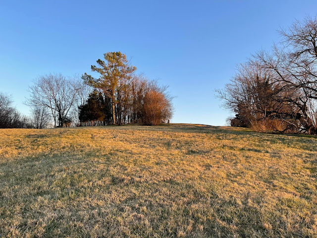
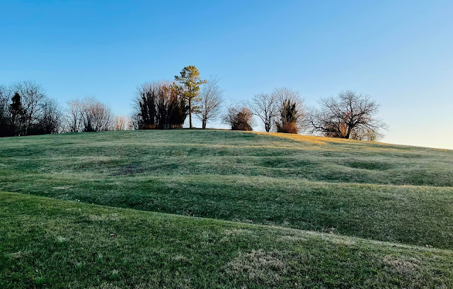
No historical marker denotes the site of the fort, which must be rectified. According to a local historian, a house once stood at the crest of the hill and the many depressions in the ground below it may be the work of a farmer rather than Yankee soldiers.

Bundled to withstand the 25-degree temperature, Jack and I walked the ground and wondered what Civil War treasure might be unearthed beneath it. Spotted: One prancing deer, one pile of bricks and one child's outdoor playset that I don't think dated to 1864.

Tipped off by a knowledgeable source about a nearby "hidden" spring used by Union soldiers, we navigated through briars and who-knows-what else to find The Spot near the railroad track. (The line follows the same path as the wartime Nashville & Decatur Railroad.) Trees, fallen limbs, mud and a lack of courage prevented an up-close inspection. Does that make us "spring chickens"?
 
"Is that gurgling over there?" I said, pointing to the spring between the "V" in a fallen tree. "Maybe," said Jack, leery of getting closer. But I think he might have been humoring me. 

A "hidden" spring used by Union Army soldiers.
One of the war's largest cavalry battles was fought here on Dec. 17, 1864.

Next we headed across the pike to The Park at Harlindales Farm, roughly 200 acres of open space in exploding Franklin. The former breeding farm for Tennessee Walking Horses includes walking and hiking trails, a dog park and the Tractor Supply Co. Arena, where they hold polo matches and horse shows. 

Midnight Sun, superstar
On Dec. 17, 1864, in the aftermath of the Battle of Nashville, the rain-soaked and weary rearguard of John Bell Hood (aka "Old Woodenhead") clashed with Federal soldiers on this ground in one of the war's largest cavalry battles. Good luck finding the fine Civil War Trails marker that tells the story of a fight only nerds diehards seem to know anything about.

Steps from the CWT marker rest the earthly remains of walking horse superstar Midnight Sun, a black stallion said to be "as powerful as the sun and as black as midnight." Powerful with the ladies, too—this "sire of sires" may have fathered as many as 2,600 foals, which must be some sort of world record. Naturally, someone built a statue to Midnight Sun after his death in 1965.  

Whew! I'm exhausted. Until next time ... let's keep history alive. 👊

The grave of Midnight Sun, a black stallion that didn't have a lot of free time.

 — Have something to add (or correct) in this post? E-mail me here.

Friday, January 28, 2022

'Hidden' in plain sight: Fort location on Franklin (Tenn.) Pike

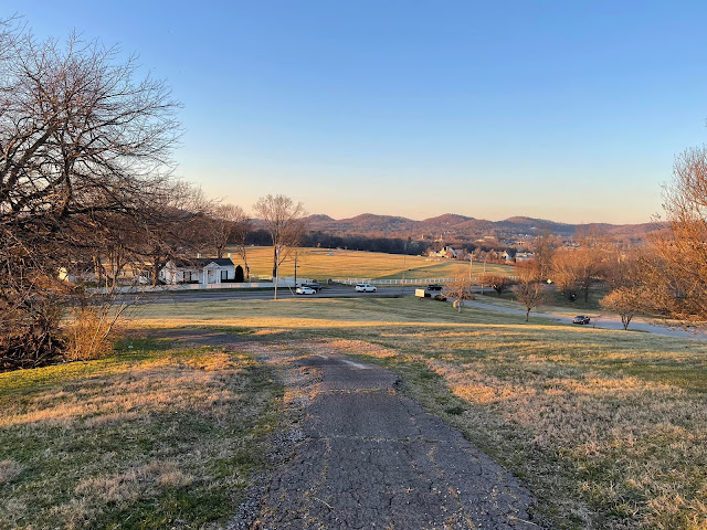
The view looking northwest of Franklin Pike (State Route 31) from the location
 of a wartime fort. (CLICK ON ALL IMAGES TO ENLARGE.)
A view from below the fort location.
Another view from below fort location. Could these be wartime trenches? Must investigate.

Like this blog on Facebook | Follow me on Twitter 

I recently explored the "hidden" location of a small Civil War fort along Franklin Pike (present-day State Route 31), a mile or so north of the square in Franklin, Tenn. The fort appears on two maps below—the first one is a cropped version of this map from the 9th Indiana Cavalry regimental history. The fort, designated by the "11," was unoccupied when the regiment fought north of Franklin on Dec. 17, 1864. On the second map, drawn by a Civil War veteran, the fort appears along the crease at the top middle. 

Thousands of U.S Army troops camped in the fields near this small fort during the war, as the second map below shows. It also shows the locations of headquarters, military and “contraband” camps and other nearby earthworks. Today those fields are occupied by houses, apartments, a park, retail, commercial … and a taco place Mrs. B is dying to visit. 

Fort Granger, a massive, earthen Union fort on the bluff above the Harpeth River, appears as that blob at the lower right of both maps. My Civil War pal Jack and I have explored the fort several times—I was even hypnotized there. It's worth your time to visit. If you really want to dig in, check out this doctoral dissertation,

Many “hidden” places like this small Franklin Pike fort remain throughout the Nashville area. So keep your eyes peeled. 😐

        GOOGLE STREET VIEW: Wartime fort location at left. Proceed south into Franklin.
Cropped enlargement of a map from 9th Indiana Cavalry regimental history shows outskirts
 of Franklin and death sites of three officers in the regiment in a battle on Dec. 17, 1864.
Map from parking lot historical marker at Fort Granger in Franklin, Tenn.
(Boyd Family Papers | Bancroft Library | University of California-Berkeley)

 — Have something to add (or correct) in this post? E-mail me here.