 |
| From left, Vanderbilt research analyst Natalie Robbins, students Jordan Rhym and Alyssa Bolster, geospatial librarian Stacy Curry-Johnson, and professor Brandon Hulette pose with a ground-penetrating radar machine at Shy's Hill. (CLICK ON IMAGES TO ENLARGE.) |
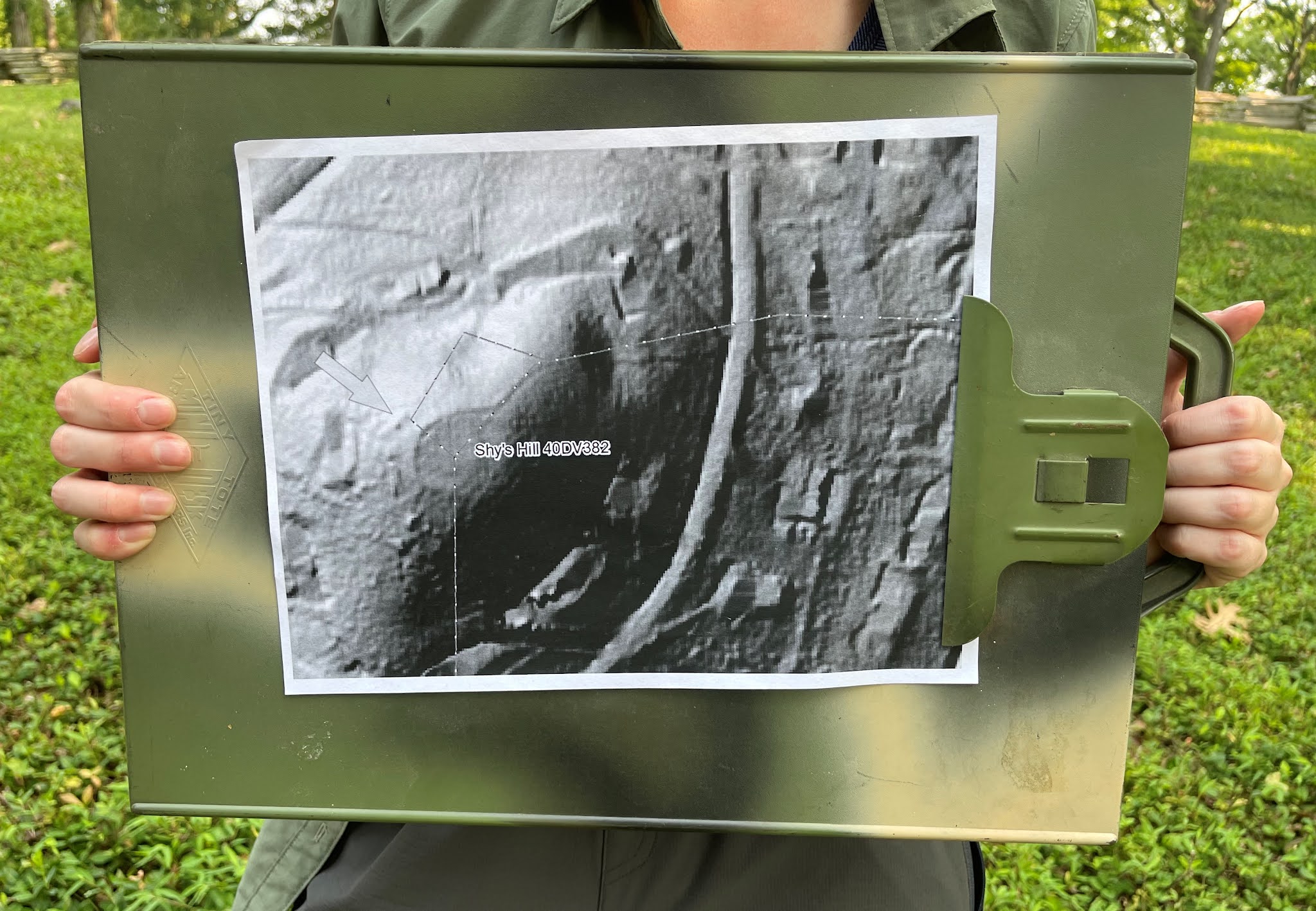 |
| The ground-penetrating radar provides an "image" of the subsurface like this one, held by Vanderbilt research analyst Natalie Robbins. |
Much of Shy's Hill was carved up more than 60 years ago by residential developers -- the very top of the hill was sliced off in the 1950s for a water tank, making it nine or 10 feet shorter than in 1864. This opening sentence from a feature story in a 1959 edition of the Nashville Tennessean makes my heart hurt: "Today Shy's Hill has been stormed, captured and occupied by building contractors and home owners. A phalanx of bulldozers led the way, and handsome brick houses now line the streets which circle the knob, halfway to the crest."
Bleh.
A small section of the hill -- the extreme left of the Confederates' line on Day 2 of the battle -- is preserved and maintained by the Battle of Nashville Trust. (Full disclosure: I am a board member.) The next time you're in Nashville, put it on your must-see list, because it's worth the hike up the steep, rugged trail to the top.
In the video below, Hulette explains the team's Shy's Hill mission:
-- Have something to add (or correct) in this post? Email me here.
SOURCE
- Nashville Tennesseean, Dec. 13, 1959.
Any idea what it costs to use (not buy) the ground radar device? I've wondered why it isn't used more often.
ReplyDeleteRalph, I've read the price is down to about 5k today, but it takes training and skill to interpret what you're looking at, sounds more complicated than simple.
Delete