 |
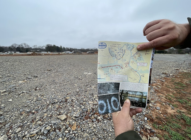
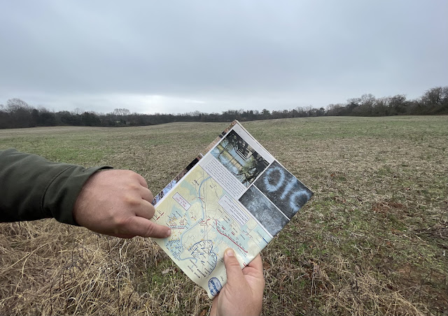
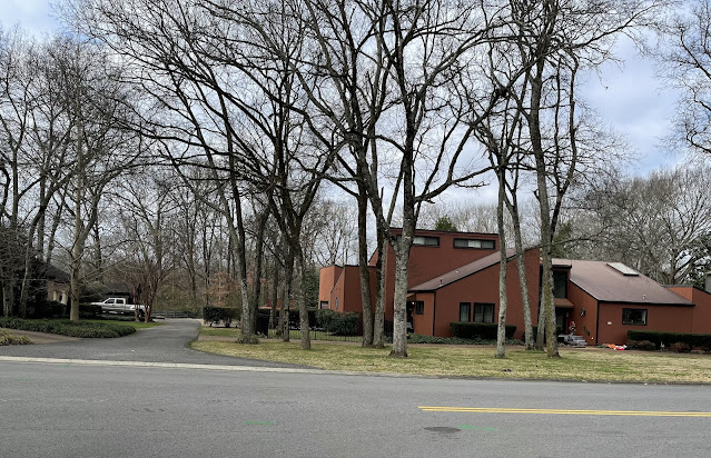
| ABOVE: On Jan. 2, 1863, Confederates advanced under fire across this ground—today it's prepped for residential housing. Stan Hutson, my guide, holds maps from Blue & Gray magazine that detail the action here. BELOW: A farm field, also hallowed ground, is adjacent to the nascent housing development. (CLICK ON IMAGES TO ENLARGE.) |
Real conversation this morning with an NPS employee behind the desk at the visitors' center:
Me: "Can you tell me where the 45th Mississippi fought?"
NPS employee, after a minute or two studying maps: "They were near the Baskin-Robbins, Sam's Club and Walmart."
Ugh.
To see the roughly 2,500 acres of battlefield beyond the national park, you need patience, a great guide, a good attitude and a world-class imagination. Maps, too. Really good ones.
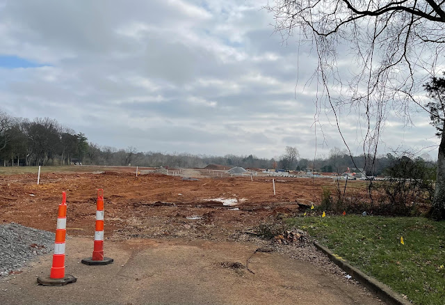 |
| Hallowed ground to housing: The site of fighting on Jan. 2, 1863, is gone for good. |
On Sunday, friend Stan Hutson—whose knowledge and love for the battlefield are unrivaled—showed me a seldom-visited site where Confederate soldiers advanced under fire near Sinking Creek on Jan. 2, 1863. (You may remember Hutson from this column I wrote about the vanishing Stones River battlefield for Civil War Times magazine, this blog post on Fortress Rosecrans and this post on his remarkable finds on a soon-to-be-paved over section of the field.)
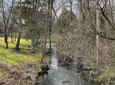 |
| The Confederates' right advanced near Sinking Creek on Jan. 2, 1863. Today it winds through residential neighborhoods. |
"That's as close as we'll probably get to seeing the battlefield as it looked on Jan. 2, 1863," Hutson tells me. He points out on a Blue & Gray magazine map the Confederate regiments who wheeled across this ground to attack the U.S. Army positioned behind us.
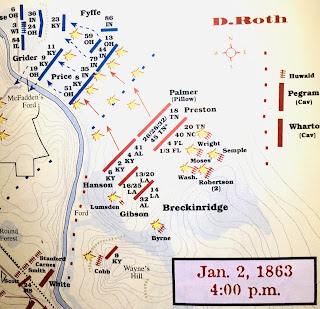 |
| Click to enlarge Blue & Gray magazine map of fighting in this area. |
In this nascent development, relic hunters have uncovered evidence of the fighting—bullets (including a French pattern .69 caliber "Triangle Base" round like this), artillery shell fragments and more. I wonder what battle artifacts could be recovered in the mountains of topsoil.
In late 2020, the American Battlefield Trust saved 42 acres nearby—a site originally destined for industrial development. That ground where little to no fighting occurred could become a park. No organization or individuals stepped up to save the site of the housing development—ground where significant action occurred.
Is it too late to save the farm field?
 |
| On Jan. 2, 1863, the Orphan Brigade advanced here and down a hill toward McFadden's Ford — today the ground is in a residential neighborhood. |
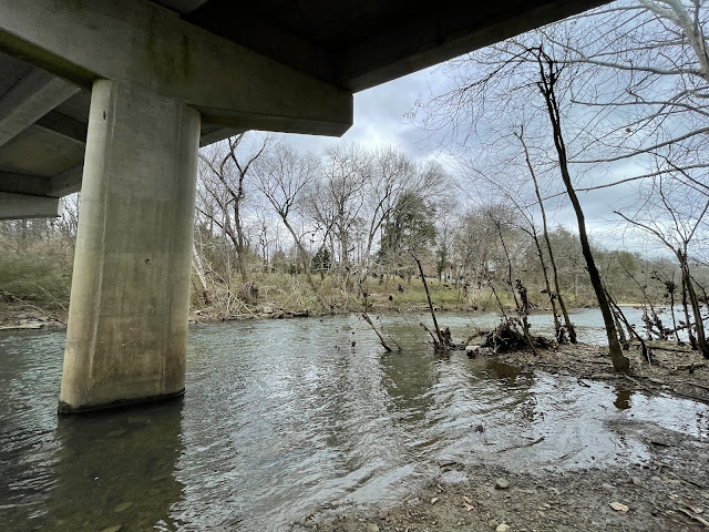 |
| Under a modern bridge, Stones River National Battlefield tourists can see the site of McFadden's Ford, where the Orphan Brigade was mauled by U.S. Army artillery. In the right distance, a modern neighborhood covers hallowed ground. |
No comments:
Post a Comment